A Professional Land Surveyor (PLS) is a state-licensed expert who applies specialized knowledge of law, mathematics, engineering principles, and geospatial science to measure, map, and define land, airspace, and water boundaries. This licensure is not merely a title; it is a rigorous credential earned through a combination of advanced education, years of supervised experience under a practicing PLS, and the successful completion of a series of demanding examinations. This process ensures that a PLS possesses the technical competence and ethical grounding necessary to make authoritative decisions that have significant legal and financial consequences for property owners, developers, and the public. The license represents a fiduciary responsibility to protect the welfare of the public and uphold the integrity of the profession.
The most fundamental and recognized duty of a Professional Land Surveyor is to establish and re-establish property boundaries. This process, known as a Boundary Survey, involves meticulous research and field work. A PLS conducts extensive research into historical records, including deeds, plats, and previous survey maps, to understand the written intent of the original land descriptions. They then go into the field with precision instruments to locate existing monuments, measure distances and angles, and gather topographical data. By correlating the field evidence with the legal record, the surveyor renders a professional opinion on the precise location of the property lines, which is then documented on a Plat or Record of Survey map. This document becomes a legal instrument used to resolve disputes, facilitate transfers of ownership, and guide construction.
Beyond boundary delineation, Professional Land Surveyors are indispensable to the construction and development industries through Construction Staking and Site Planning services. Before a single foundation is poured, a PLS interprets engineering and architectural plans to physically locate the proposed structures on the land. They meticulously set stakes and markers that guide contractors in the precise placement of buildings, roads, utilities, and grading. This critical step ensures that construction adheres to the design specifications, complies with local zoning setbacks and ordinances, and avoids costly encroachments onto adjacent properties or public rights-of-way. Their work is the crucial link between the abstract design and the physical reality of a built project.
Professional Land Surveyors also specialize in mapping the natural and man-made features of a tract of land through Topographic Surveys. These surveys measure and map the elevation of the ground, along with the location of features such as trees, streams, ravines, buildings, fences, and utility poles. The data collected is used to create detailed contour maps that are essential for architects, engineers, and planners. These maps inform critical decisions regarding drainage, grading, roadway design, and overall site layout, ensuring that development is harmoniously integrated with the existing environment and is structurally sound.
The expertise of a PLS extends into the legal arena, where they often serve as expert witnesses in court cases involving boundary disputes, easement conflicts, and allegations of professional negligence. Their authoritative opinion, backed by thorough research and proper methodology, carries significant weight with judges and juries. Furthermore, Professional Land Surveyors prepare legally binding documents such as Subdivision Plats and Condominium Plats, which legally create new parcels of land for sale and development. They also document and map Easements, which are rights for specific use of a property held by someone other than the owner, such as for utility access or a shared driveway.
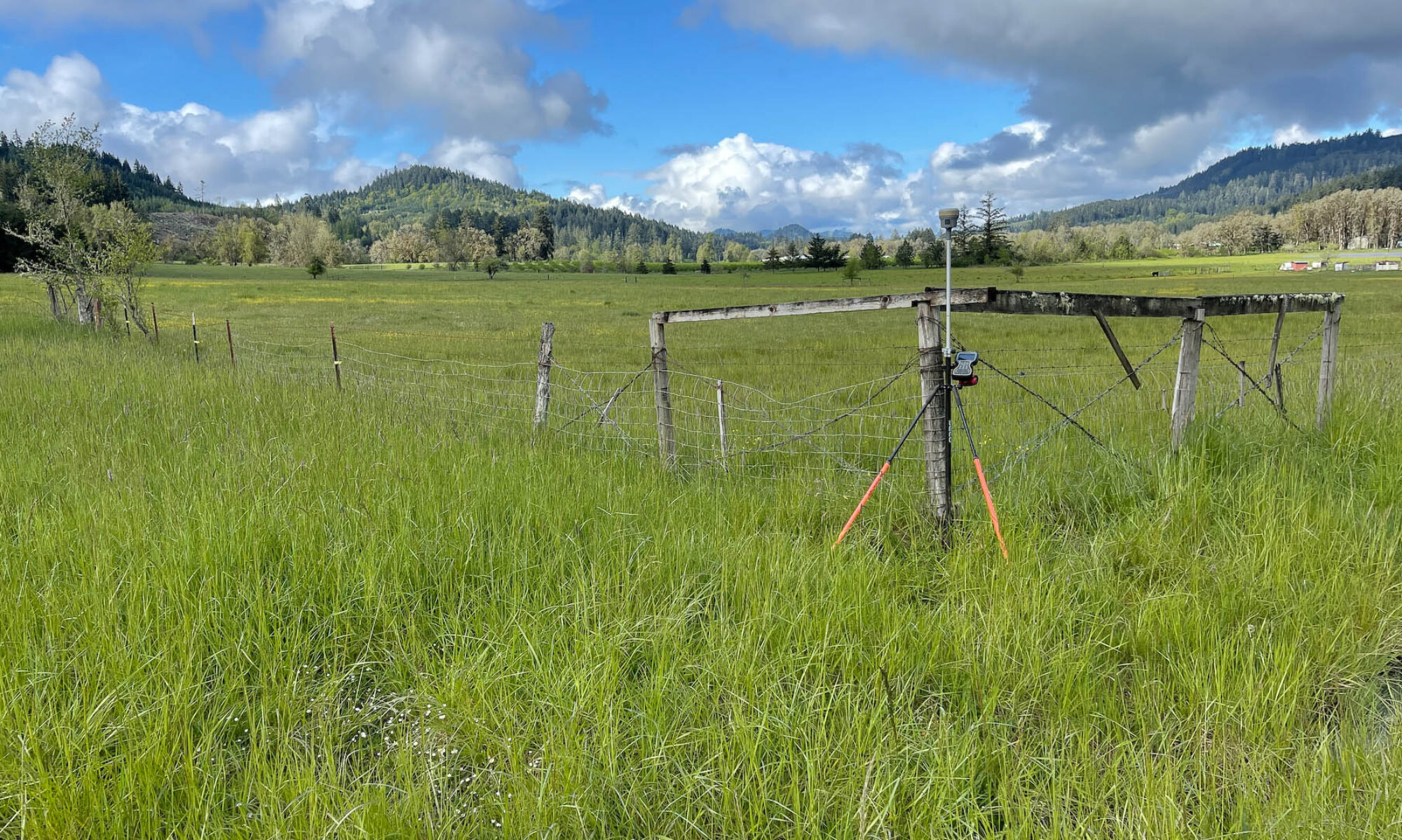
In the modern era, the tools of the trade have evolved dramatically, and the Professional Land Surveyor is at the forefront of this technological integration. While the foundational principles remain constant, today’s PLS utilizes advanced technology like robotic total stations, high-precision GPS (GNSS) receivers, terrestrial and aerial LiDAR scanners, and sophisticated CAD and GIS software. This technology allows for unprecedented levels of accuracy and efficiency in data collection and mapping. Ultimately, the role of the Professional Land Surveyor is one of a trusted advisor and guardian of the built environment, applying timeless principles with cutting-edge technology to bring order, clarity, and certainty to the land.